 City - Sheridan County, North Dakota City - Sheridan County, North Dakota
Address:
Boone Township
1,114.5 Acres in Sheridan County
List Price: $2,925,000.00
This
land is currently rented for the 2024 crop season and provides an
excellent income. The buyer will get possession of the land for the 2025
crop season.
There are approximately 950.47 acres of very good cropland with average
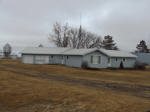
PI’s ranging from 49.3 to 75.4. There is a farmstead with some
improvements (house, pole barn, Quonsets and bins) and there is 60 acres
of good pasture. Much of this land is contiguous or very close and it is
all located in Boone Township.
The total real estate taxes for 2023 were $8,462.93
Legal Descriptions:
E2SE4, S2NE4, Section 10, Township 147, Range 74 (160 acres), 140.85
acres of cropland according to FSA with an average PI of 49.3. 2023
Taxes - $1,148.71
NE4, Section 14, Township 147, Range 74 (160 acres), 129.31 acres of
good quality cropland according to FSA with an average PI of 75.4. 2023
Taxes - $774.51
NE4, SE4, E2W2, Section 30, Township 147, Range 74 (480 acres), 447.23
acres of good quality cropland according to FSA with an average PI of
66.4 and a farmstead of 8.5 acres.
This parcel includes the farmstead and buildings. The buildings are
being sold in “as is” “where is” condition with no warranties
whatsoever. The well and septic are also being sold in “as is” condition
with no warranties. 2023 Taxes - $4,473.35
NE4, Section 31, Township 147, Range 74 (160 acres), 91.74 acres of
cropland according to FSA with an average PI of 61.7 and 60 acres of
good fenced pasture. 2023 Taxes - $931.88
NE4 less R/W, Section 32, Township 147, Range 74 (154.5 acres), 141.34
acres of good quality cropland according to FSA with an average PI of
72.5. 2023 Taxes - $1,134.48
All crop acres are +/- according to the FSA aerial maps.
This property is being sold without mineral rights and is subject to any
existing easements and rights of way of record. There are USFW Easements
in perpetuity on all of the property except the E2W2, Section 30.
The property is located in Boone Township, 3 miles North of Goodrich.
Some of the parcels are located along 19th Ave. NE, 20th Ave. NE, and
10th St. NE.
Plat
Map PDF:
Click here
USFWS Map PDF:
Click here
USFWS Map 30 31 32 PDF:
Click here
FSA Aerial Map Section 10 PDF:
Click here
Soil Map Section 10 PDF:
Click here
FSA Aerial Map Section 14 PDF:
Click here
Soil Map Section 14 PDF:
Click here
FSA Aerial Map Section 30 PDF:
Click here
Soil Map Section 30 PDF:
Click here
FSA Aerial Map Section 31 PDF:
Click here
Soil Map Section 31 PDF:
Click here
FSA Aerial Map Section 32 PDF:
Click here
Soil Map Section 32 PDF:
Click here
|